Maps. I love everything about them. I love looking at them, using them, and exploring them. As a kid, I hoarded the insert maps that used to come with National Geographic, and I had a small library of AAA maps. In college, I was the nerd with a 6-foot-long wall-size map of Africa in my bedroom. Today, I’m not much different. I spend more hours than I care to admit just randomly exploring Google Maps.
So I was obviously excited to see a few map-related books land on my doorstep in the last few weeks.
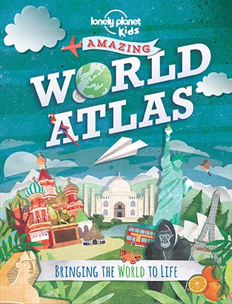
Amazing World Atlas by Lonely Planet Kids
The Lonely Planet Kids imprint is relatively new, but it’s most decidedly a welcome addition to the sprawling LP line.
You can’t get much more nerdy with the map love than with an atlas. They’re a treasure trove of mappy goodness. Sadly, they’ve also become almost entirely neglected in an age of Google and Wikipedia. I certainly recognize the limitations of a printed atlas in a world of ever-changing boundaries, political regimes, and exported products.
Thankfully, the Amazing World Atlas doesn’t focus on minutiae. For a kid, this book is like traveling around the world in 160 pages. Filled with factoids, tidbits, important dates, and hundreds of photographs, the book engages kids with information about the world.
Where’s the planet’s most crowded spot? How to say “hello” in Kurdish? When and why was the Antarctic Treaty signed? What’s the fastest land animal in Canada?
There are maps here, obviously, but many of them are stylized or hand-drawn. Indeed, this book is more “a mind-blowing mix of history, culture, and fascinating facts” (from the back cover) than strict atlas.
If you’re a map nerd or culture-hound or if you’ve got the travel bug (even the armchair variety), this book is great fun to flip through. It’s also fantastic to read aloud to younger kids in small chunks or for older kids to explore on their own.
Good for K–8.

Maps Activity Book by Aleksandra & Daniel Mizieli?ska (Big Picture Press)
This activity book invites kids to get “down and dirty” by coloring, adding to, or creating their own maps. Physically, the book is designed so kids can tear out the pages and let their inner cartographers/artists shine though.
This book also uses maps as a starting point to engage kids more fully with social studies and world cultures.
Various pages invite kids to draw a map of an imaginary country, invent their own petroglyph symbols, draw animals on a map of Australia, draw a Thai floating market, and add to a map of Russia and the Trans-Siberian Railway by adding animals and landmarks they might see along the way. All told, there are more than 70 pages and activities here.
The reverse of each activity page includes brief facts that are related to the activity. From these, kids can learn a bit more about durian, Lake Titicaca, kimonos, and flamenco, just to name a few.
For my budding artist/naturalist/world traveler, it’s just about perfect.
Good for K–5.

Information Graphics: Space by Jennifer Daniel (Big Picture Press)
Let’s leave our pale blue dot behind for a bit and head out to the final frontier. Big Picture Press has put out a few book in their Information Graphics line (Animal Kingdom and Human Body were previous titles), and Space is the newest title.
Think of this as an atlas to the universe. Broken into seven sections (from the vastness of The Universe to the familiarity of The Earth and Moon to the relative personal nature of Observing Space), the book uses simple and clever infographics to convey information.
Therefore, we get cross-sections of fruit to help us compare and understand the relative size of the planets in our solar system, a clear visual representation of what happens during an eclipse, simple graphics that contrast different kinds of stars and galaxies, and a surprisingly effective (and downright simple) image that explains the basics of a black hole.
To be clear, these pages just scratch the surface of any of these topics, and curious kids will absolutely be left wanting more. But that’s sort of the point. The Information Graphics series isn’t meant to present in-depth scientific information. It’s meant to explain complicated concepts simply and whet your appetite for more. And, with that in mind, it’s brilliant.
Good for 3(ish)–8(ish).

Adventures in… Series by Lonely Planet Kids
These might be straining the conceit of this theme somewhat as they’re not really “map books.” However, they’re put out by Lonely Planet, and they serve a similar purpose as the books above: they strive to get kids more interested in the world.
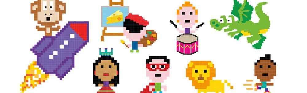
Adventures in Smelly Places, Adventures in Noisy Places, and Adventures in Famous Places are the newest titles in this series of activity/sticker books.
Taking a cue from the Amazing World Atlas, each page is packed with facts and images. There are no photos here, though. Each spread is filled with imaginative drawings and engaging characters and animals.
Pages also alternate between matte-finish activity pages on which kids are invited to color and draw and glossy pages on which kids are supposed to place the variety of (more than 250) stickers included in the back of each book.
As is probably obvious from the titles, each book focuses on a specific theme. Smelly Places explores some of the smelliest places and things (both good and bad) in the world. We visit chocolate factories, vanilla plantations, and bat caves, and we learn about durian, the world’s smelliest birds, and some of the stinkiest cheeses. Noisy Places and Famous Places have similar journeys, just without the odors!
In addition to the activities and stickers, each book also comes with a pop-out 3D model to make (bat cave, rocket, and rocky mountain). We’ve been having loads of fun with these books.
Good for K–5.