
Credit: NASA/JPL/University of Arizona
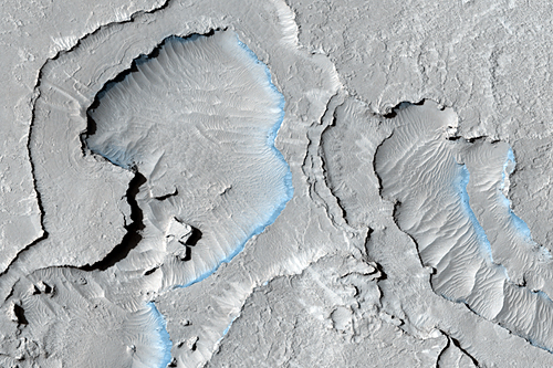
The High Resolution Imaging Science Experiment (HiRISE) on board NASA’s Mars Reconnaissance Orbiter (MRO), has just begun a monthly image release schedule. In the first of this new, accelerated PDS (Planetary Data System) archival program, they’ve released 64,704 image products totaling 1.7 TB (yes, that’s 10244 or 240 bytes, not bits) of data. Among the release are 114 unique anaglyphs (3-D images that you view with red-blue glasses for purchase here) and 16,861 raw image products. Full statistics are here. This release includes data acquired between 16 January 2009 and 4 April 2009, whereas the monthly releases will include…about a month’s worth of data. Once the data are archived in the PDS, anyone in the world may use them for virtually any purpose although science and conspiracy theories seem to be the most common uses.
To date, HiRISE (nicknamed “The People’s Camera“) has released more than 990,000 images totaling about 34 TB, including almost 279,000 raw image data products (9.5 TB). Although they have generally released data at least a few months ahead of their contract schedule, the team has begun a PDS-archival rate that far exceeds that of any other instrument team in the history of the PDS.
MRO orbits at about 300 km above the martian surface, giving the HiRISE camera a 30 cm/pixel ground scale and about 1 m resolution*. For comparison, many google maps images were taken with a scale of about 0.6 m/pixel, with a resolution of about 1.8 m. The width of a HiRISE image is about 6 km or 20,000 pixels with a 1.2 km strip of color in the center, and the length can be up to a maximum of about 126,000 pixels or 37 km. With such a small instantaneous field of view (1 microradian), HiRISE expects to image—at full resolution—not more than a few percent of the martian surface over its lifetime.
I think it is safe to say that HiRISE has revolutionized Mars science. Actually the several instruments on MRO have all contributed to giant leaps in understanding the red planet, but I’m a fan of HiRISE in particular. The unprecedented center color strip, the unmatched pixel scale, and the signal-to-noise ratio of about 200:1 all provide astounding detail of the martian surface that is only beaten by the rovers and landers, but is not limited to regional coverage like the surface instruments. Combine that with MRO’s screaming fast bandwidth of 6 Mbps (but beware those ping times!), the average daily downlink volume of around 230 Gbits (not all HiRISE), and you have a recipe for too much data for one team to handle. This is why the team decided when the instrument was conceived that they would release the data as soon as was feasible, given data processing and verification demands.
*As an aside—I don’t want this to devolve into a debate on pixel scale vs. resolution—when you read that an image has a resolution of 5m/pixel, that’s the scale of a pixel on the ground, not necessarily the smallest object recognizable; resolution is correctly specified in units of length (5 meters, 2 feet, etc.). Resolution is affected by many factors including the signal-to-noise ratio, atmospheric dust or clouds, lighting conditions, whereas ground scale is simply a function of the optics and distance from the surface.
(Full Disclosure: Moses works with the HiRISE science, calibration, and operations teams. They have not seen this post prior to its submission. Any factual errors and all opinions herein are solely his—as a private individual.)


