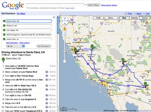
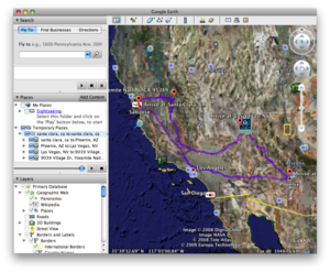
If you took the geeklets on a long drive over the river and through the woods this holiday weekend, or if you’ve got some long drives coming up, you can use Google Earth to do super-cool 3D-flyovers of your whole trip. Google Earth has some basic abilities to generate directions itself, but you can also bring multidestination maps over from Google Maps and make your trip flyover easy to make. Let’s go through a quick tutorial.
First you’ll need to download Google Earth, of course. If you just have one destination then you can do everything inside Google Earth. Simply go to the address bar and choose the "Directions" tab, then put in your starting and ending point, then click on your starting point, then press play. That’s it, you’ve got a 3D flyover of your trip.
If you don’t want all the specific highway directions to display, you can simply turn off the checkboxes in the list.
This is a neat feature, but you might already have a carefully tuned multi-destination map all set up in Google Maps. If you’d like to bring that over you’ll need to first convert the file into a format that Google Earth can use, called a KML file. First let’s expand the simple trip from Santa Clara to Phoenix and add in a stop in Las Vegas and Yosemite.
From here, right-click and copy the link from the Link area on the top right. Now go to this link converter page on Nearby.org.uk, a fun site with lots of Google Earth toys, and paste in your link text from above into the URL section. You’ll get a link to a KML file that you can download to your computer. Just open this file in Google Earth and you’ll have your customized route ready to fly over. Pick the starting destination and press play and your fly-through will start. Call over the kids and amaze them with your flyover, and teach them a little bit about the Earth while you’re at it.
Google Earth is a huge and complex piece of software, and there is a lot more customization you can do from here, including adding your own photos or adding in information from other sites such as Wikipedia. If you want to go further you can find a set of tutorials on the Google Earth site.


